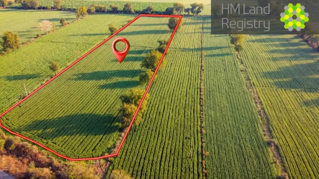
Title Plans That Pass Land Registry — First Time, Every Time.
Boundary disputes, missed sales, rejected plans — Title Plans can be a minefield. We make it simple: clear, compliant drawings that get accepted, fast.
Avoid delays, disputes, and rejections from Land Registry.
Whether you’re registering land, splitting a plot, or selling off part of a property, Title Plans need to be precise. Get them wrong and you’re looking at delays, disputes, and wasted legal fees.
Land Registry Title Plans & Ownership Boundaries
Get accurate, HM Land Registry–compliant Title Plans for sales, remortgages, transfers of part and boundary clarification. We prepare clear drawings that show the red-edged demise, shared/common areas and rights of way — ready for your solicitor or conveyancer to submit.
How We Get Your Title Plan Approved in 3 Easy Steps.
No jargon, no back-and-forth — just a compliant plan your solicitor can submit with confidence.

We Capture Your Property
LiDAR scan or existing plans — whichever gets the job done right.
We’ll measure every boundary line with extreme accuracy. No tape measures, no guesswork, just the precision that Land Registry requires.


We Produce Your Title Plan
Ready within 48 hours. Compliant and watertight.
you will receive your Land Registry–compliant Title Plan: to scale, edged in red, and ticking every box the Registry looks for. In other words — approval-ready.


Your Solicitor Submits It
We hand the plan to your solicitor. They send it in. With over 1,000 approvals under our belt, you can trust it won’t bounce back with corrections or delays.
Boundaries clear. Stress gone. Clients happy. Google agrees.


| Included as Standard | Local Surveyor | Online-Only |

|
|---|---|---|---|
| Fixed, transparent pricing (no surprises) |  |
 |
 |
| LiDAR scanning for millimetre accuracy |  |
 |
 |
| Work from your existing floor plans |  |
 |
 |
| Plans ready in as little as 48 hours |  |
 |
 |
| 1000+ successful Land Registry approvals |  |
 |
 |
| Experience throughout the entire South East of the UK |  |
 |
 |
| Personal service with in-person meetings |  |
 |
 |

What Is a Land Registry Title Plan?
A Title Plan is the official plan held by HM Land Registry identifying the extent of a registered title. It must reflect the OS base mapping, scale requirements and clear edging/colouring conventions, so that ownership limits are unambiguous.
How to Get a Land Registry Title Plan
Share details — address/Title Number, any deeds or old plans, and what’s changing (sale, split, boundary).
Site check (as needed) — we verify measurements and access/rights on the ground.
Draft & review — you/your solicitor review a proof; we refine any annotations.
Final issue — PDF (and DWG if required) with correct scale bars, north arrow and legends.
Title Plans Done Correctly
Title Plan Requirements (What We Include)
Correct scale (typically 1:1250 urban / 1:2500 rural) with scale bar & north point
Red edging for the demise; blue/green tinting for rights, easements or retained land
Clear boundary lines, offsets and tie dimensions where helpful
Access/rights of way and shared spaces labelled
Notes to clarify any exceptions, covenants or retained strips (when instructed)
Common Scenarios We Support
- Transfers of part (splitting plots/flats/outbuildings)
- Unregistered land first registration plans
- Boundary regularisation and clarification after disputes
- Development phases showing parcels, access and easements
Our Process & Turnaround
- Fast quote from address + purpose + any existing plans
- Drafts in 1–3 working days for standard titles (complex sites by agreement)
- Optional site survey/LiDAR scan where accuracy beyond OS mapping is required
Why Choose SurvDesign
HMLR-compliant output checked against current practice guides
Clear, lawyer-friendly drawings that minimise requisitions
End-to-end support: Title Plans, Lease Plans, and related boundary plans

Get In Touch
Building 13, Thames Enterprise Centre, Princess Margaret Road, East Tilbury, Essex, RM18 8RH
- Phone: 0800 494 7023
- Hours: Mon-Fri 8:30AM - 5:30PM

Get In Touch
Building 13, Thames Enterprise Centre, Princess Margaret Road, East Tilbury, Essex, RM18 8RH
- Phone: 0800 494 7023
- Hours: Mon-Fri 8:30AM - 5:30PM