
Planning Drawings That Councils Can’t Say No To.
We turn your ideas into council-ready drawings that cut through delays and keep your build moving.
Planning Drawings That Councils Can’t Say No To.
We turn your ideas into council-ready drawings that cut through delays and keep your build moving.
Plans Approved. Clients Delighted. Google Agrees...

Review on behalf of my parents- Mr & Mrs Sparrow
We were really struggling to get our Land Registry plans approved due to confusing and unhelpful advice from a solicitor. Then we spoke to Kev — and what a difference! With just one quick call, he clearly explained what needed to be done and suggested we submit both our own and our neighbour’s plans together. Thanks to his expert advice, everything was approved straight away.
He completed the plans quickly, efficiently, and at a very reasonable price. No stress, no hassle — just a great service from start to finish.
Absolutely brilliant. Highly recommend Kev to anyone needing Land Registry Compliant Plans.

Kevin is flexible, listens to what has been asked. He is knowlegeable about ideas and suggestions and gives you leave options.
The plans were clear to read and were done to a professional high standard.
If you live in Essex and want a good value price then Kevin is the man to contact.
My plans were submitted on Monday as the price is going out and they were done in a timely manner.

Kev from Surv Design was incredibly helpful when we needed land registry compliant plans drawn up for our leasehold property. After a couple of months when our buyers solicitor came back asking for revisions to be made, we received these within a couple of days. Thank you Kev for making a stressful process much easier! We are very grateful for your time and help!

Kev and the team have been amazing at working with me to ensure my planning application goes through smoothly. I live in a conservation area so it was daunting to even begin the process but Kev put me at ease straight away.
Communication has been great and I would highly recommend Surv Design.

My experience in dealing with Mr Kev Miller of Essex Architects and Party Wall Surveyors is one of thankfulness. Having discussed my problem with Kev, which he fully understood, I sent him some follow-up details which were used by him to give a quick response. I am extremely grateful for his time, knowledge and understanding in dealing with my problem.

I use them first time Mr kev Miller is the best man I ever seen and very reasonable price and very good service he handling our case smoothly he is very knowledgeable and friendly we got approved our side double extension and back 6 metre extension. Thank very much kev for your hard work.

Excellent service from Kev and Millie at Surv Design. Would not hesitate to recommend them to anyone.

Straight forward talking and great communication from start to finish. Highly recommended for your project.
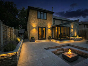
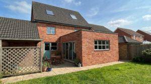
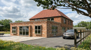
Project Case Studies

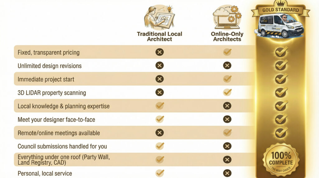
What Makes Us The Gold Standard?

Quick Links
Get In Touch
Building 13, Thames Enterprise Centre, Princess Margaret Road, East Tilbury, Essex, RM18 8RH
- Phone: 0800 494 7023
- Hours: Mon-Fri 8:30AM - 5:30PM

Get In Touch
Building 13, Thames Enterprise Centre, Princess Margaret Road, East Tilbury, Essex, RM18 8RH
- Phone: 0800 494 7023
- Hours: Mon-Fri 8:30AM - 5:30PM
